Hærvejen
Along the old Military Road in Jutland, April 2002
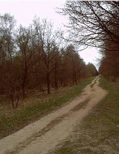
The Road
Although Denmark has no mountains, it's still very hilly due to the movement of the melting ice near the end of the Ice Age some 10,000 years ago. The resulting ridge down the axis of Jutland constitutes a watershed, and along this divide runs what is known today as the Military Road . The name is just one of many names for this road as it has been used for many purposes, the best known being that of a highway for driving cattle south to the cities in Northern Germany.The oxen route is thus perhaps the most fitting of the various names ascribed to the road, but historians have pointed to the military interest of kings to maintain a road that would allow easy and swift transport to the southern border whenever the occasion would arise.
True, there are many earthworks, ramparts and walls in these parts, some of them going back almost 2000 years, and it is now generally believed that even in prehistoric times the road was a major route - if not the only route south - due to the many moors and streams in other parts of the country.
For cattle as well as people these streams were difficult to pass (and drivers had to be on the lookout for possible thieves, i.e. wolves) so fords or crossings had to be found and maintained which gave rise to inns and custom houses with pens or corrals. In the 1700s sturdy stone bridges were built to replace the oldest wooden footbridges.
Not surprisingly, the major town on the route is called Vejen (the Road) as it was situated where the (only) traffic was.
Hærvejen
The road itself was often maintained through a special tax which put farmers under the obligation of clearing the road, often for as long as 30 kilometers away from their homes; the section of the road to be kept was marked by special markers of duty.
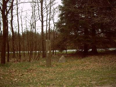 Duty markers
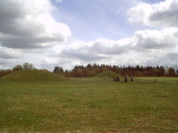
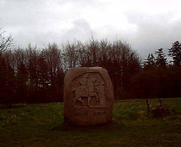
These markers are still to be found as are the prehistoric markers in the shape of barrows, monoliths and runic stones with inscriptions of who ordered them erected and who carved them. The runic alphabet goes back about 2000 years, but the main body of the 200 stones with runic inscriptions found in Denmark date from about 1000 A.D.
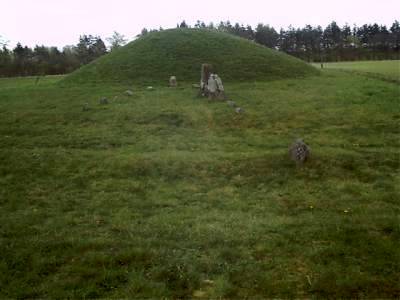
Right alongside the road are several hundreds of prehistoric burial mounds and barrows which points to the fact that these parts along the ridge have always been populated, and the road thus seems to have been a natural thoroughfare between prehistoric settlements.
Important people who wanted to be remembered or merely point to their power would want to display their command of the territory where the most people would see it, i.e. right on the road.
Barrows and a stone ship setting flanking the road

A bit of more recent history is shown where battlements indicate the threat of war. Apart from several ancient walls still to be seen where approaching armies would have to pass, perhaps the most interesting "monuments of defense" are the 900 concrete bunkers built by Germany during WW1 when a British attack from the North through the then neutral Denmark was feared. Most of the bunkers were later blown up, but some 30 still remain displaying a miniature Maginot Line across Denmark. Interestingly enough, the geographical position of the line corresponds to that the old earth walls.
To understand why Germany built fortifications in Denmark one has to remember that from 1864 to 1920 the southern part of Denmark had been ceded to Germany. The border was then Kongeåen, a stream with the fitting name the King's Stream running across Jutland.
German bunker from 1914-18
The Trip
We began our tour of the Military Road in present day Germany, just south of the border - remembering that in the Middle Ages this was still part of Denmark, in fact, all the way to the city of Hamburg - and worked our way north from there. Our first stop was actually the youngest historic marker of our trip, the concentration camp in Froeslev where Danish Communists were interned during WW2.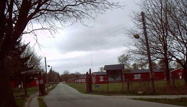
Froeslev - complete with barracks, gates, and watchtowers
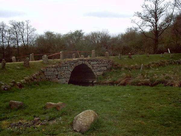
Barrows and Bridges
In Denmark proper our first stop was at one of the spectacular bridges that serve as fix points for the course of the road. As is the case of the Oregon Trail in the US there are several parallel routes that have served as the Military Road in the course of time with occasional fix points through which everybody had to pass. Most of these are where the streams were crossed, and today bridges mark these crossings. Near the bridges are the old inns, and around them the pens (often called "Paradise") where the cattle were rested while the cattle drivers were resting inside.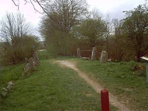 Gejlå - bridge and stream
 Near the bridge is a huge stone relief commemorating a French nobleman
who in the 1700s dodged his bill at the inn by revealing the recipe of
a famous "schnapps" known as Bommerlunder.
Near the bridge is a huge stone relief commemorating a French nobleman
who in the 1700s dodged his bill at the inn by revealing the recipe of
a famous "schnapps" known as Bommerlunder.On returning from the South many cattle drivers teamed up in groups to be better able to defend themselves against highway robbery. Some of them actually buried their earnings along the roadside at nightfall, which in turn - when the owner didn't return to claim his belongings - has given us a fairly good insight as to how much they carried in silver and other 'imported' goods. But the findings also reveal that the route is, indeed, prehistoric as some of these treasures belong to prehistoric times.
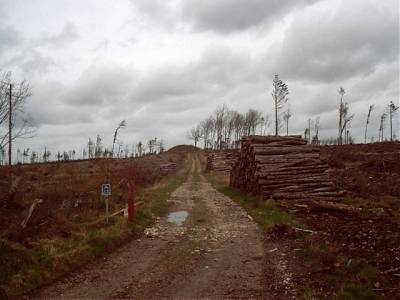
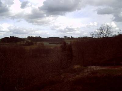
One recent instance of finding buried treasures was when a big storm knocked over most of the trees in the southern regions of Denmark in the late 1990s.
The picture below shows the devastating effect on the countryside, but it also adds to the impression of the often rough conditions along the road:
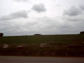
 Note the barrow in the horizon - barrows are always situated high
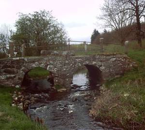
 The gem of the bridges is the one called Povlsbro (Paul's Bridge),
situated very romantically. The rounded design of the bridge is simple
yet stunning in its simplicity.
The gem of the bridges is the one called Povlsbro (Paul's Bridge),
situated very romantically. The rounded design of the bridge is simple
yet stunning in its simplicity.The surrounding pen is clearly visible and sloping down towards the stream, and the elevated position of the road itself is thus underlined.
Older bridges like the rightly famous one at Immervad (see below) had a different rectangular structure. Either way, such bridges required highly skilled builders, and the whole construction was often supervised by the king's representatives as from the 1600s on the king would travel widely and in horse pulled carriages.
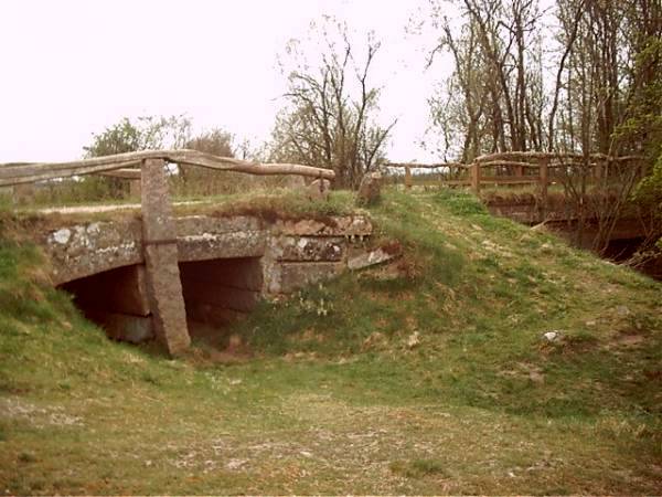 Immervad - old and new bridges
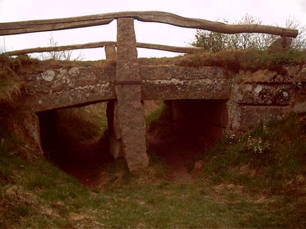
The old bridge at Immervad - the stream is now dry due to a relocation of its course
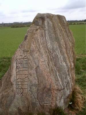
The Markers
 Apart from the prehistoric old barrows and single-stone uncarved monoliths
most of the tourist's interest concentrates naturally on the runic carvings
on the stones erected along the highway. Most of these stones were found
in fields, but they have later been moved to places of general interest and
importance such as churches.
Apart from the prehistoric old barrows and single-stone uncarved monoliths
most of the tourist's interest concentrates naturally on the runic carvings
on the stones erected along the highway. Most of these stones were found
in fields, but they have later been moved to places of general interest and
importance such as churches.Despite the odd mixing of heathen tradition and Christianity, the old runic stones blend in naturally as a reminder of the country's past like the one at Laeborg Church (right).
Runic inscriptions (carvings) tend to be uniform:
"[name] erected this stone in commemoration of [name] ",
often with the artist's signature: "[name] carved these runes."
A certain name may appear on more than one stone; either the ruler of the region (and who ordered the stone carved and erected), or the (traveling) artist (who may thus have served more regions than just the immediate neighborhood).
The runes are letters which run in parallel lines from bottom to top or round in a spiral if the inscription is longer than the length of the stone will allow.
The older runic alphabet (0-700 A.D.) consists of 24 letters some of which resemble the Latin letters; the language is Old (Primitive) Norse. The younger runic alphabet from c. 600-1050 has 16 letters which still allows for the addition of an extra a-sound and an extra r-sound, probably a result of the change in the spoken language which took place after the great migrations. The language is identified as Old Danish.
Originally designed to be carved in wood there are no horizontal lines in any runic letter, and it seems that writing was known only to a few (hence the recurring names of the artist).
Runes were known all over the North and used as the regular way of writing until the advent of movable print around 1500. Since most runic carvings have been found in Denmark, it is generally believed that runes are Danish in origin.
A famous stone is the Hairulf stone.
The inscription reads (from the bottom upwards):
H A I R U L F R
the first "r" being a flapped "r", the second a back (of the tongue) consonant .
Apparently, the inscription is unfinished.
In the adjoining field is a barrow with a monolith:
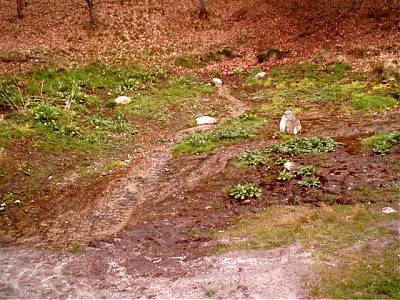
Most of its length the road is clearly visible and passable (by car, bicycle, or on foot), but in parts it's barely distinguishable. These parts are perhaps the most interesting of all as they constitute the original unspoiled track:
 Original tracks crossing left to right in
front of barrow with monoliths at Baekke
Original tracks crossing left to right in
front of barrow with monoliths at Baekke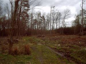
At other times it is tempting to pronounce an ordinary logging road THE ROAD (right),
but most of the time the route is clearly marked with signposts indicating the right direction.
For 50 years the most important marker in South Jutland was the stream called Kongeåen, the King's Stream, a name that has a very special ring of nationalism, especially to the elder generation of Danes.
The stream itself is not otherwise important, but due to the special nature of the nationality of South Jutland (the duchy of Schleswig-Holstein over which two of the most recent wars were fought in 1848 and again in 1864), the name of Kongeåen has come to symbolize the loss of Danish soil to Germany.
Wars have been fought in these parts almost right from the beginning of history, and nationalistic
bards have sung the praise of the heroes that stood up to enemy from the south.
 Kongeåen
 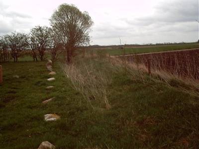 Of the many pre-medieval earthworks built to protect the Danes from attacks
from the south, Vendersvold is one of oldest. Little is
left of the original wall, but in places the general design is still there
(right: view east, and below: further west).
Of the many pre-medieval earthworks built to protect the Danes from attacks
from the south, Vendersvold is one of oldest. Little is
left of the original wall, but in places the general design is still there
(right: view east, and below: further west).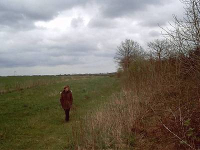
Vibeke inspecting the earthworks at Vendersvold
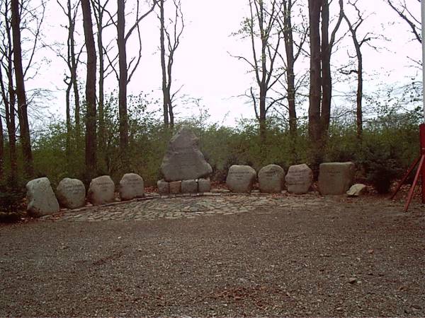 At Urnehoved is a remarkable collection of stones commemorating
the importance of the place. More than a thousand years ago this was
the southern thingstead, i.e. the court of peers - that of
Viborg being the one to the north, and Ringsted (a corruption of Thingstead)
the one in Sealand. This was where kings were crowned, and the magnitude
of the place is quite overwhelming when one looks at the many stones that
tell of Danish history. Unlike common belief, Southern Jutland was always
the more important part of Denmark as it was closer to (the civilized) Germany,
and it wasn't until Absalon and the Valdemar-kings took over that Copenhagen
and Sealand grew to any importance from the 1200s on.
At Urnehoved is a remarkable collection of stones commemorating
the importance of the place. More than a thousand years ago this was
the southern thingstead, i.e. the court of peers - that of
Viborg being the one to the north, and Ringsted (a corruption of Thingstead)
the one in Sealand. This was where kings were crowned, and the magnitude
of the place is quite overwhelming when one looks at the many stones that
tell of Danish history. Unlike common belief, Southern Jutland was always
the more important part of Denmark as it was closer to (the civilized) Germany,
and it wasn't until Absalon and the Valdemar-kings took over that Copenhagen
and Sealand grew to any importance from the 1200s on. Like all the historic places mentioned in this article, Urnehoved is right on the Military Road.
Miscellaneous
 So many are the markers along the road that any diary will only mention
but a selection. Besides, the above tour only covers the southern part
of the 200+ km long Military Road.
So many are the markers along the road that any diary will only mention
but a selection. Besides, the above tour only covers the southern part
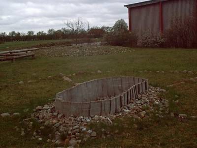
of the 200+ km long Military Road. Among the more curious stones are for instance a series of concentric prehistoric "wheels" marked by stone settings, and an adjoining, worn down 'barrow', which held the remains of two adults (right):
 Numerous markers celebrate the reunion of Denmark (after 1920) - after
all, this is the stronghold of folk high schools - but the region abound
in many curious markers like the one below left: a signpost giving directions.
Numerous markers celebrate the reunion of Denmark (after 1920) - after
all, this is the stronghold of folk high schools - but the region abound
in many curious markers like the one below left: a signpost giving directions.The writing says: "Weg nach Süder Lügum" - the road to South Loegum.
Other national markers display the message of "God, country, and honor":
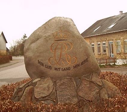
Being elevated some 300 feet above sea level the military road overlooks the land. The Juttish 'ridge' is thus the starting point for many streams, among them the two longest Danish 'rivers', those of Skjernå and Gudenå. Actually, their sources are in close proximity within 400 meters.
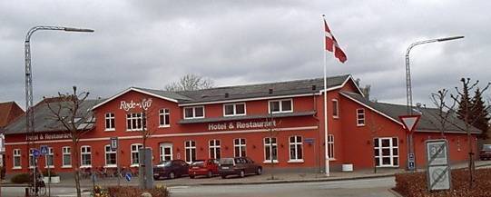
However, the best known place of all is probably the inn that gave name to a town and a whole region: that of Roede Kro (the Red Inn).
The inn is still a center of activities - here in its modern shape, but it's still red and white, like our national colors:
April 2002
Erik Moldrup